Pacific Crest Trail Hikers Will Face Coldest Weather in Northern Cascades
 The Appalachian Trail (AT) and Pacific Crest Trail (PCT) face their weather trials and tribulations inversely. As noted previously, the AT starts at its very highest elevations in the southern Appalachians. And to thru-hike that 2,180 mile national scenic trail, it is necessary to begin in early spring. Thus, you can expect cold, wet weather in the early going, that can border on dangerous.
The PCT is just the opposite. PCT thru-hikers start their 2,663 mile journey in the scorching heat of the desert. After 703 miles, they enter the very highest points in the entire continental United States, the ‘High Sierra’. Yes, it is very cold at night here, and hikers must layer accordingly. After beautiful, sunny days, the thermometer can easily fall below freezing. However, PCT hikers usually do the High Sierra in early summer when the possibility of precipitation is low. Thus, they can expect to warm up very quickly in the morning, and the possibilities of hypothermia are small. In fact, most years a PCT thru-hiker will get nary a drop of precipitation until probably northern Oregon.
However, at the very end of the PCT, thru-hikers enter the Northern Cascades in Washington State. This rugged mountain range is renowned for both its jagged peaks and bleak horizons. Further, the PCT hiker arrives in the early fall when the weather becomes notoriously unpredictable. In fact, the largest glaciers in the country (outside of Alaska) are in northern Washington State. At the PCT Kickoff Party, ex-hikers habitually advise the current year’s crop to “be finished before October 1st. The weather after that is totally unpredictable.” Amen. That is indeed sage advice.
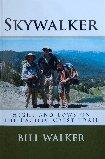
I did not finish the PCT until October 9th, because of injuries, fires in northern California, and snow drifts in northern Washington. That meant that in early October I found myself galloping as fast as I could along the gnarly ridges of the northern Cascades, trying to get to towns such as Snoqualmie, Skykomish, and Stehekin, and ultimately to Manning Park just beyond the Canadian border. At times the weather was crisp, clear, and bracing, to the point of heavenly. But on two different occasions, we got hit with early snowstorms that made forward progess both difficult and perilous. These were the highest snow levels we had yet seen on the Pacific Crest Trail. Often the only way forward was following other hiker’s footprints, as the trail was completely out of sight. In Skykomish, as recounted in my PCT narrative, Skywalker–Highs and Lows on the Pacific Crest Trail, a large group of us was snowed in for several days and forced to bow to reality and take a ferry to Stehekin through Lake Chelan, the deepest lake in the United States. From there it was a demanding 90 mile jaunt to Manning Park just over the Canadian border.
Had we finished by October 1st, we wouldn’t have had such weather problems. But, of course, the PCT is 489 miles longer than the Appalachian Trail. I had been going all out for over 5 months, including losing 43 pounds! But I simply wasn’t fast and strong enough to get the ship to port before the first of October. And that left me in the worst weather that a PCT hiker can face, there in the northern Cascades in autumn–wet and cold, and possibly dangerous.
Bill Walker is the author of Skywalker–Highs and Lows on the Pacific Crest Trail. He is also the author of Skywalker–Close Encounters on the Appalachian Trail, as well as The Best Way–El Camino de Santiago. Walker, who is nearly 7-feet tall, is currently working on a book on the subject of height.


Follow Us!