Low Snow Levels Give Pacific Crest Trail Thru-Hiking Class of 2013 a Big Advantage
 “Have you heard any snow reports?’
PCT (Pacific Crest Trail) thru-hikers are accustomed to spending the winter before their thru-hikes obsessing over snow levels in the so-called ‘High Sierra’. For good reason. The High Sierra is the most daunting and beautiful part of the PCT. Hands down. This section both haunts and beckons. It’s all about the snow.
In 2006, the year after my AT (Appalachian Trail) thru-hike, I wanted to then attempt a thru-hike of the PCT. However, all winter I followed a website showing the water content of snow levels in the High Sierra. It was running consistently double that of normal. The water content of the snow was so important because that indicated how many streams a thru-hiker would be forced to ford and how difficult it would be. Ultimately I called off my 2006 thru-hike attempt due to the high snow levels that year. It was a good decision. It was a good decision, I now know. For in 2009 I headed out to thru-hike the PCT in what was considered an average snow year. Nonetheless, I found it about all I could handle.
PCT hikers are advised in Yogi’s PCT Guidebook and at the annual Pacific Crest Trail Kickoff Party to try to go into the High Sierra around June 15th. This is known as ‘Ray Day’. The High Sierra begins at mile 703 at Kennedy Meadows. Hikers ship food, winter clothing, bear canisters, and sometimes ice axes and crampons there. After 703 miles in the desert, including the western corner of the famed Mojave Desert, the terrain dramatically changes. The milieu changes from the stark, saline austerity of the desert to the green lushness, snowcapped peaks, and rushing water of the Sierras. It is beautiful. But again, you had better be ready. What’s more, the Sierras had better be ready for you!
For the average hiker like myself, the icy mountain passes and crashing streams of the High Sierra can represent the challenge of the lifetime. Don’t get me wrong: they weren’t the stuff of Bear Grylls or Edmund Hillary. They weren’t diabolical in terms of difficulty. Nonetheless, the margin of safety was frightfully small in places like Mount Whitney and Forrester’s Pass, or crossing streams such as Evolution Creek. But again, it’s all about the snow. I went into the High Sierra on June 19, 2009; it was the time of my life. But it was harrowing in places, because of the steep snow fields we ascended and descended, usually following footprints. I could not have possibly made it through the High Sierra that year had I entered a couple weeks earlier. I am 6’11” and a high center of gravity means that it is especially difficult to maintain the critical balance necessary.
“Why not go in later, when the snow has melted?” a person might ask. Indeed, that is when John Muir Trail hikers traverse the High Sierra–July or August. But this not possible for the PCT hiker, because he (she) would not then have enough time to make it to Manning Park in Canada where the northern terminus of the PCT lies. Thus the PCT hiker must thread the needle and enter the High Sierra late enough to be able to make it through safely, but early enough to make the remaining 1,800 miles of the trail. It is all a delicate dance. But a worthwhile one, as the Pacific Crest Trail is probably our nation’s most gorgeous national scenic trail.
The PCT thru-hiking class of 2013 seems to have serendipity on their side, as snow levels are reputed to be the lowest in almost 5o years. Reports are that many have already entered the High Sierra, as of June 1st. This is a huge advantage. They will have plenty of time to comfortably make it to Canada, if they maintain their pace thus far. It also allows time for contingencies such as routing around fires in northern California, which has become a virtual rite of passage for PCT thru-hikers. The Northern Cascades have their own brand of beauty, and thru-hikers want to have plenty of time to enjoy them. Our year, large sections of thru-hikers got stranded late in the season at Skykomish, with no certain way to make it over the snow drifts on Glacier Peak in northern Washington; ultimately they were forced to take a ferry over Lake Chelan to make it to the last town of Stehekin.
But the class of 2013 shouldn’t have this problem now that they are entering the High Sierra well before Ray Day. Best of luck, and I am very envious.
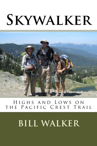
Bill Walker is the author of Skywalker–Highs and Lows on the Pacific Crest Trail. He is also the author of Skywalker–Close Encounters on the Appalachian Trail, The Best Way–El Camino de Santiago, and Getting High–The Annapurna Circuit in Nepal. Walker, who is nearly 7-feet tall, is currently working on a whimsical book on the subject of height.


Follow Us!